Free application (for Android) to replace speedometer for bicycle. It could be used for any other outdoor activity, like walking, running etc.
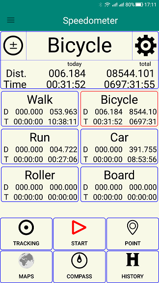
Stopped
Shows distance and time for activities.
Selection of activity.
Setup of selected activity.
Start.
Download / select map
Load path - from gpx file.
Access to history.
Double click on title for single / two columns.
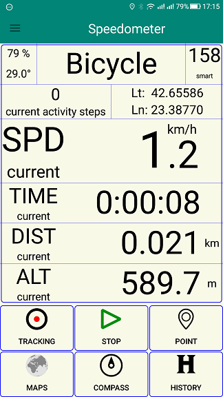
Started
Shows:
- Battery; Activity name; Satellites / direction.
- Steps, coordinates. Click on coordinates to go to map.
- Speed (current, maximal, average).
- Time (current, today, all).
- Distance (current, today, all).
- Altitude - start, current, minimal, maximal.
Start / stop tracking, adding of way points.
Steps - only if you have step sensor. Direction as compass if you have geomagnetic sensor, and only direction of movement.
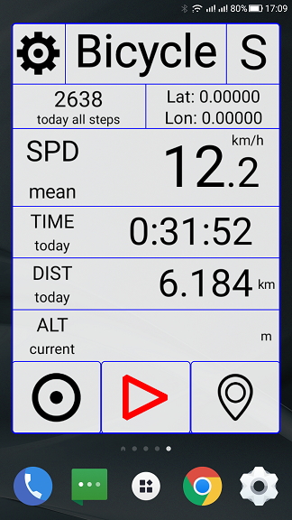
Widget - full
Shows:
- Activity name; Satellites / direction.
- Steps, coordinates. Click on coordinates to go to map.
- Speed (current, maximal, average).
- Time (current, today, all).
- Distance (current, today, all).
- Altitude - start, current, minimal, maximal.
Click on coordinates to go to maps.
Click on setup icon to go to main application.
Click on S for fine tuning of widget.
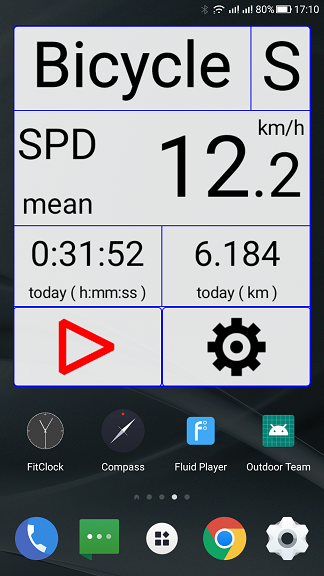
Widget - compact
Shows:
- Activity name; Satellites / direction.
- Speed (current, maximal, average).
- Time (current, today, all).
- Distance (current, today, all).
Click on setup icon to go to main application.
Click on S for fine tuning of widget.
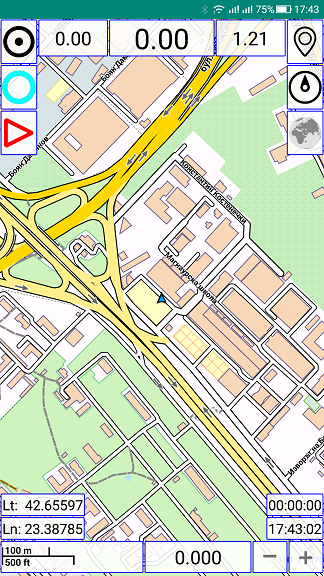
Maps
Load tracks - from gpx files.
Turn on / off.
Start / stop tracking, adding way points.
Click on speed or distance for hiding /showing some elements.
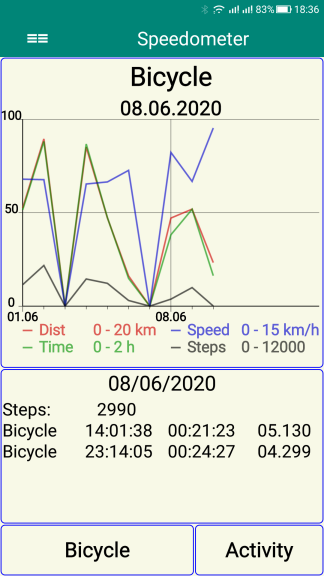
History (graph view)
Slide left / right in top band (above 50) for high speed (14 days at once).
Slide left / right in bottom band (bellow 50) for low speed (day by day).
Click on screen below for detailed day history.
We display multiple values, each of which has its own limits.
Bottom limit is equal to 0, and top - to 100.
Click on text in bottom screen to get detailed history for this day.
You can click or slide bottom buttons.
Activity - activities for which there is history.
Elements - distance, time and steps. Select using right button.
Long press on history button to get graph view.
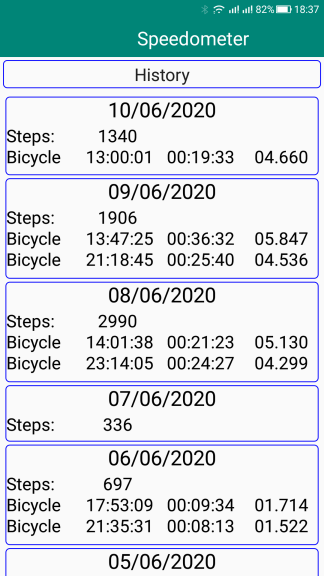
History (text view)
Display only days with some data.
Click for detailed history of this day.
History - for every session, we save all parameters (listed above).
Option for easy tracking, adding way points, and loading routes (gpx files).
Maps - users should select a map for their region.
Widgets - for easy access to most functions of application.
Setup - modify total distance and time, and more…
We do not require registration, or any personal data. But you can exchange or share route (gpx) files...
Maps belongs to their providers, and can be downloaded from:
http://ftp-stud.hs-esslingen.de/pub/Mirrors/download.mapsforge.org/maps/
In the application, we use different libraries including :
https://github.com/mapsforge/mapsforge/
Application, can be decomposed and you can use parts of it under LGPL v3.
Contacts & Copyright
office $ stribogkonsult.com
Copyright © 2019, 2020 Stribog Konsult
EULA
This program is distributed in the hope that it will be useful, but WITHOUT ANY WARRANTY. Without even the implied warranty of MERCHANTABILITY or FITNESS FOR A PARTICULAR PURPOSE.